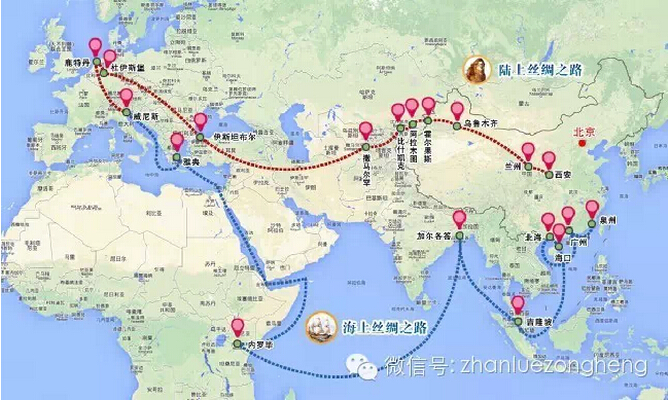
A map which illustrates the "One Belt, One Road" initiative of China. [File Photo: Weixin]
China released new regulations on maps on Monday to boost development of geographic information industry.
Included in the new regulations, which were signed by Premier Li Keqiang and will go into effect on Jan.1, 2016, is a new chapter on online map services, as well as new rules on compiling maps.
Geographic maps are of great political, scientific and legal importance, as it draws the territory of a country, directly reflecting its national sovereignty and political views, a statement released by the State Council, China's cabinet, said.
With the recent rapid development of the geographic information industry in China, significant changes have taken place in compilation, content and forms of maps.
Hence, formulating the regulations is crucial to strengthening the management of maps, safeguarding national sovereignty, security and interests, and boosting development of the geographic information industry, said the statement.
The new regulations stipulate that China will promote innovation and application of geographic information science and technology, establish a healthy mechanism for sharing geographic information resources and advance public service.
The document has an independent chapter regulating online map services, which specifies rules for market entry, data security management, user information protection, supervision and registration of internet map services.
The regulations require online map services to ask users' permission before collecting and using information, and shall stop transmitting and report to related authorities when contents that are not allowed to be shown are detected during map information transmission.
The document also stipulates that entities compiling maps shall possess mapping qualifications, and governments shall provide free use of nonprofit maps to the public and update the maps regularly.
It also includes rules on checking and publishing maps.

